
EXPERIENTIAL GALLERY
Singapore City Gallery
The Singapore City Gallery is highly popular with locals and tourists alike. The gallery went through a 3 year revamp, keeping what worked in the past and improving on new contents, making it even more interactive and engaging.
“What if Singapore had chosen a different concept plan in 1971? “
The newly revamped gallery provides more than just answers to Singapore’s city planning challenges. It asks questions of how Singapore was planned, and makes visitors think about the possibilities: “what if?”
Thought-provoking, informative and highly interactive, the gallery engages the visitors throughout their visit, so complex contents can be experienced with ease.
Content refresh
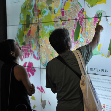
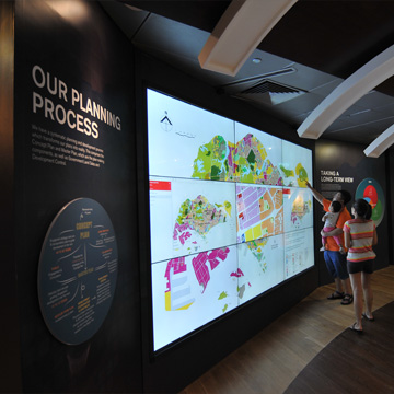
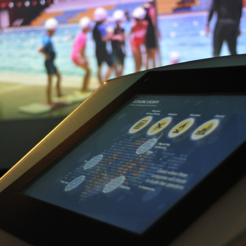
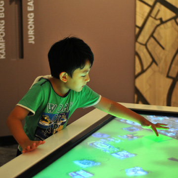
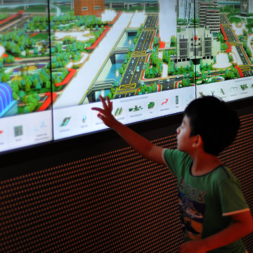
Popular exhibits retained get a content refresh with new looks. A large interactive video wall hosts the masterplan map, where visitors can click and navigate around the live, online masterplan map.
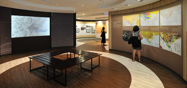
Mapping Singapore
A new “Map Room” now occupies the previous model-makers’ workshop on level 2.
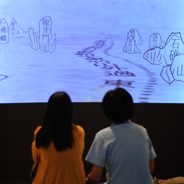
Maps are not just navigational aids and historical records; they are also used by urban planners in many ways. Here, visitors see Singapore’s development through the eyes of interesting maps.
In this series of 4 motion graphics video, important early maps come to live, and visitors learn about the significance of each one.
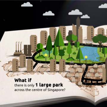
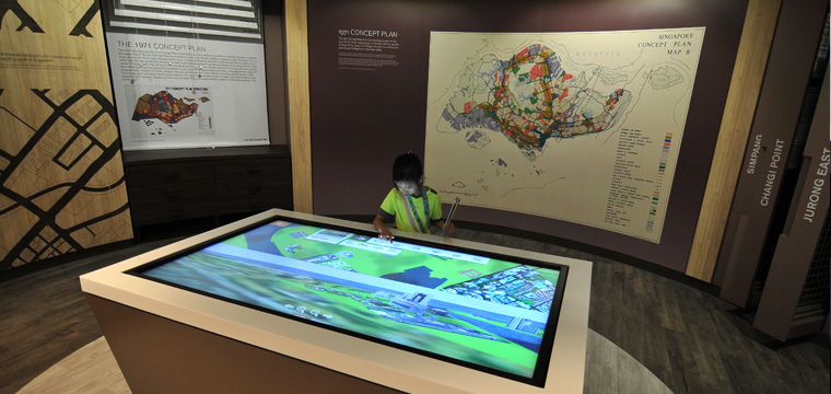
The 1971 concept plan shaped the way Singapore is today. But many other possible plans were studied then. What if we had chosen a different topology? How would Singapore look like today?
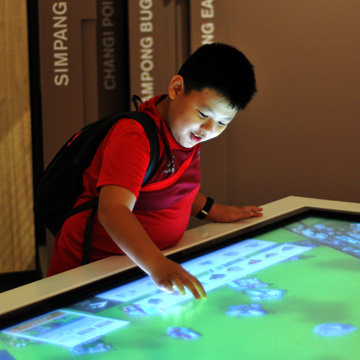
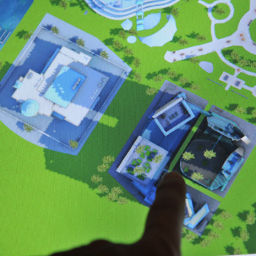
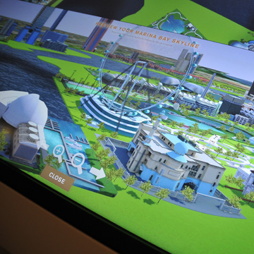
Alternative Realities
Alternative Realities is a highly popular and child-friendly realtime 3D city creation program. From a rich palette of 3D assets and land reclamation & removal tools, the user can turn Marina Bay into an industrial park, a residential estate, or even a large resort. In fact, He can re-shape Marina Bay anyway he wishes, limited only by his imagination.
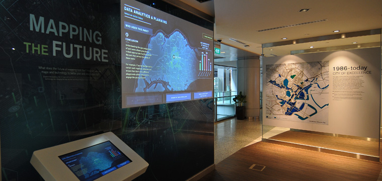
Mapping the Future
This motion graphics video and interactive simulation demonstrates how maps can be used together with infographics to visualise urban big data, so planners can better understand usage behaviours and urban patterns.
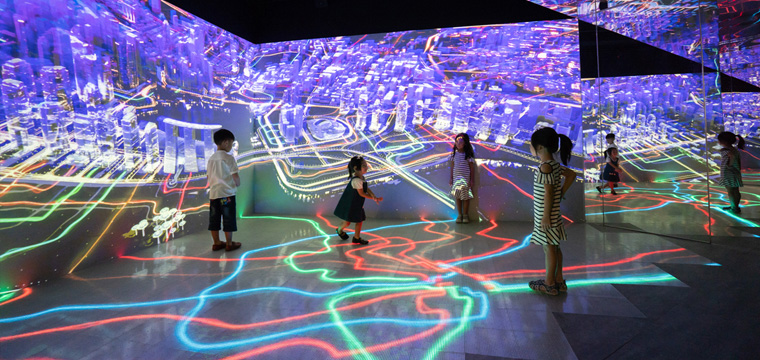
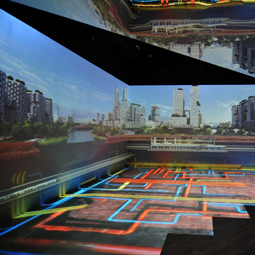
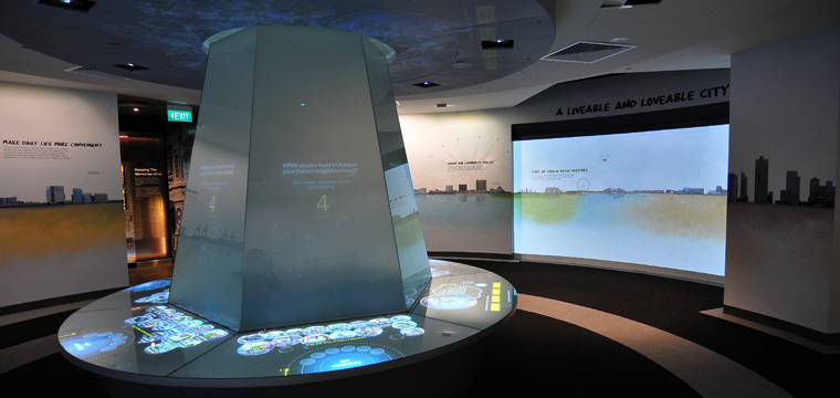
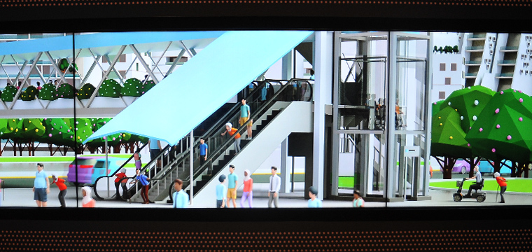
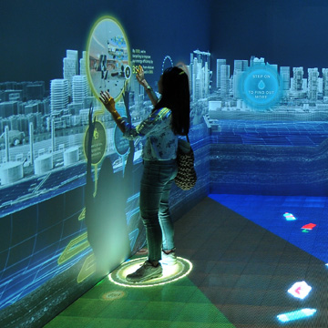
How Our City Works
The centrepiece of the revamped gallery, this immersive and interactive space is visually stunning yet engaging. It is created with an interactive LED floor and touch sensitive wall where contents react to visitors’ every movement. Visitors witness how the city runs like a clockwork underground, where urban sub-systems of water, waste, energy, greenery, and transport synergise with each other, and our limited resources are managed efficiently.
After the show, visitors can interact with the projection wall to find out how they can change their lifestyle to help reduce the loads on our infrastructure.
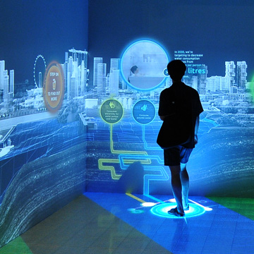
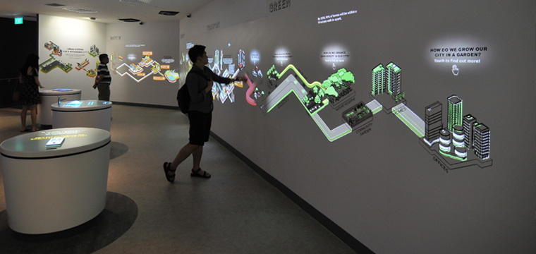
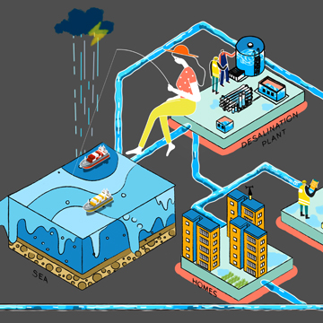
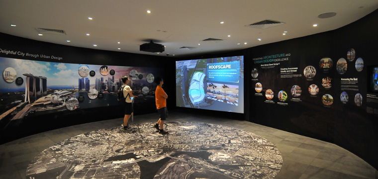
Integrated Infrastructure
The infrastructure world is complex. Through a real depicting of infrastructure facilities around the island, visitors can observe this complex network, and understand how each layer is connected to the other.
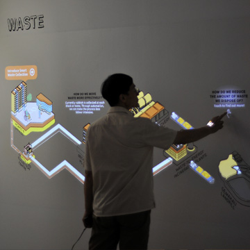
Infrastructure sub-systems
The projection mapped graphics wall is quirky and informative. Touching the wall turns graphics alive. Through animated illustrations, visitors learn about the resource loops, and key features of each sub-system.
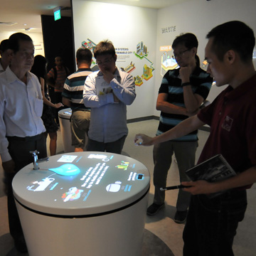
Interactive stations – Waste, Water and Energy
In these 3 interactive hand gesture games, visitors learn about what they can do to reduce waste, water and energy.
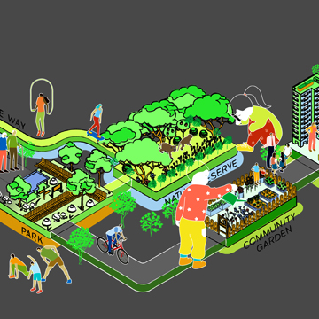
Shaping Singapore
Our preferred life-styles shape Singapore. Visitors select bubbles from the “Vortex” to reflect lifestyle preferences. After the group poll is done, a corresponding future residential district will be shown on the projection wall.
Personal Journeys
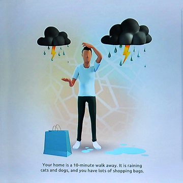
“SingCity” began with a city full of cars, and “SingCitizens” were tired of the long jams and polluted air caused by it.
This story-based role-play game lets visitors make transport choices based on their needs.Through the choices they make, players make “Singcity” a more efficient and pleasant place to live in.
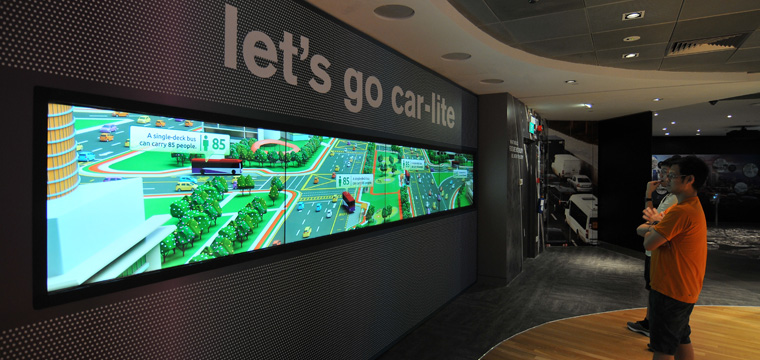
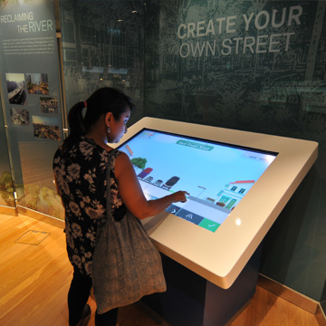
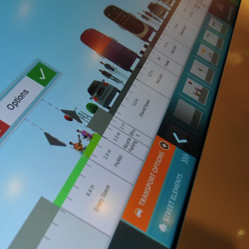
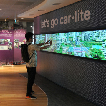
Streetmix
Design a street in Orchard or in Ang Mo Kio. All visitors need to do is drag and drop elements onto the street. By mixing the correct number of lanes for buses, cars, and bicycles, the necessary transport throughput and carbon footprint can be met. There is more, you can even turn the street into a buzzling neirghbourhood!
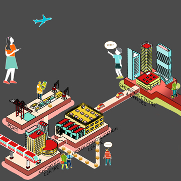
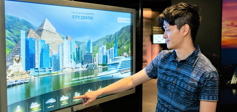
Urban Design Elements
Here, visitors learn about elements of urban design by mixing-and-matching visual street elements. How would Orchard Road look like if there were no trees and a street full of banners? What if our skyline is a mix of different architecture styles and heights?
Urban Design Flythrough
Follow our flying camera through Marina Bay and uncover urban design elements in this motion graphics 3D flythrough.
Project Information
Gallery Design: Creative Edge Consultants
AV Systems, Design and Production: MMP
Builder: DSG